Saturday, September 4, 2021

2021 TNGA Recap

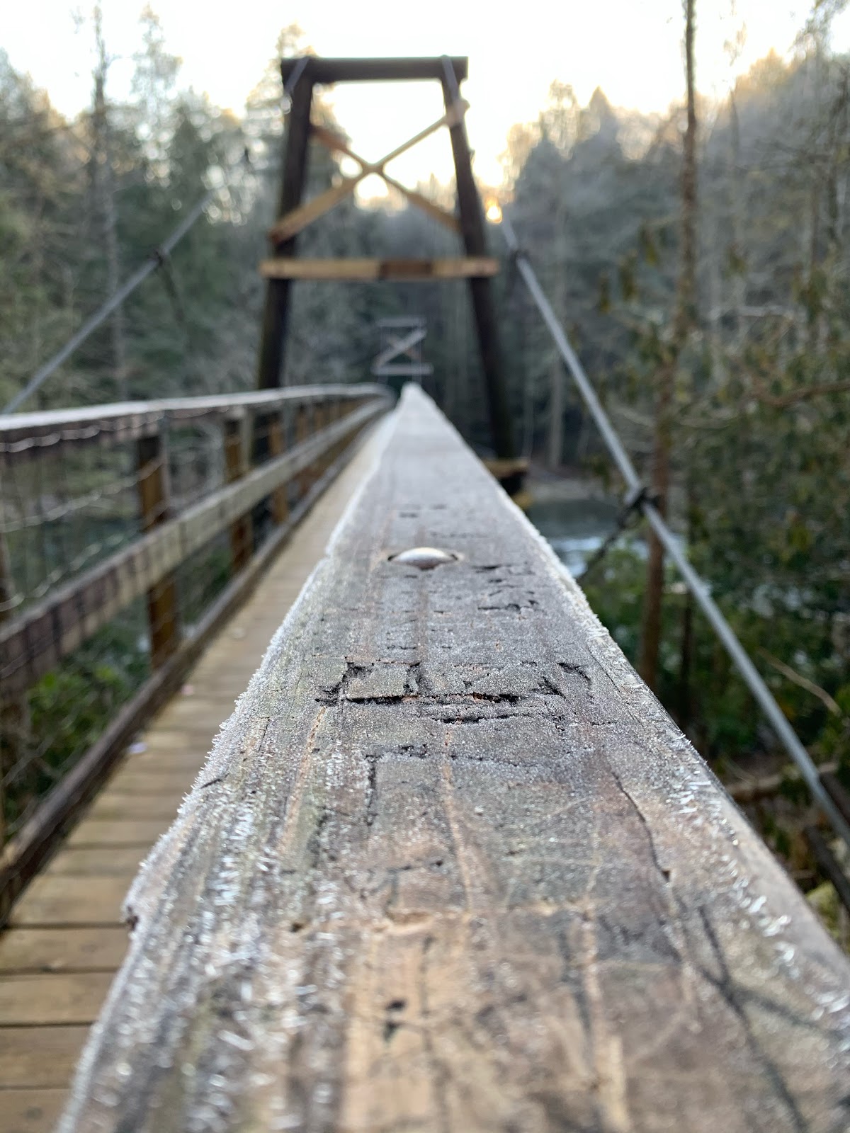
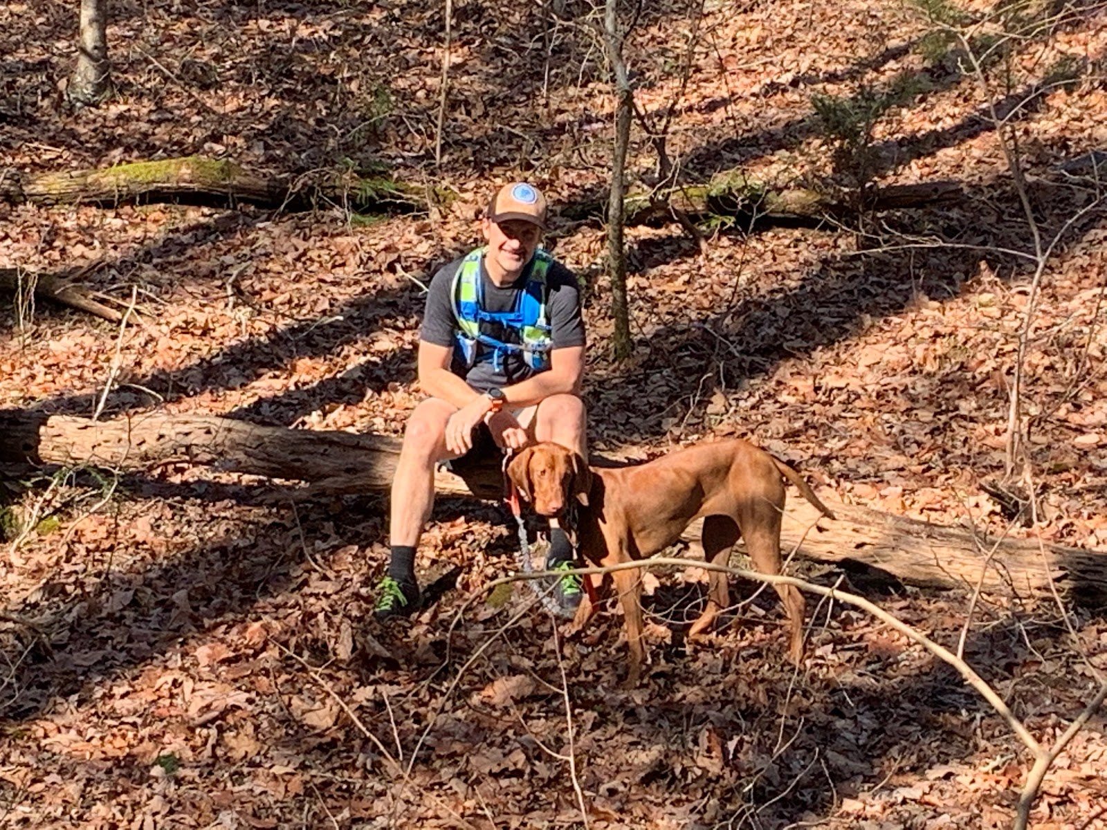
9/21 Day 1: At starting line over the Chattooga river

Overview
TNGA stands for Trans North Georgia Adventure.  It is a self supported bike packing race through the North GA mountains from SC to AL.  This is my second time doing this event, my first being in 2019.  A big difference for me this year is that I didn't train as much.  Things are busy and there just hasn't been as much time for getting out there for super big rides.  Earlier this year I "ran" the Cruel Jewel 50 miler and didn't die.  I hoped that I'd have enough base fitness from that to get through TNGA in a reasonable amount of time and without injury.  

I had several ideas I wanted to try out this year.  My feet were the biggest issue the first time around.  I wore my SIDIs and they were not the best choice for all of the hike a bike.  I wanted to try flats and a walkable shoe.  I also wanted to try sandals to see how that would work with all of the water on the course.  There are numerous creek crossings, especially in the first few days.  These crossings soak your shoes and socks.  If your feet stay wet for too long you end up with swamp feet, which can become painful and hard to recover from.  I know several riders have a sock rotation protocol that seems to work well for them.  I could of tried that, but I had an idea to wear sandals and see how my feet would do.  Seemed like it might work.  I found a pair of Keen sandals that were comfortable about a week before the race but didn't know if they would be comfortable after 8, 12, 18 hrs of riding.  I decided that I needed a back up plan and also took my Shimano bike shoes.  Yeah, I carried two pairs of shoes in the name of science.  It was all a big experiment.  Long story short, sandals are not a good idea.  The amount of grit that enters the shoe will grate on your skin and cause a different set of issues.  My feet were tore up after a few days and I switched back to my Shimanos.  Lessons learned.  

Another idea I wanted to try was to use a bivi instead of a tent and to do it without a sleeping pad.  Some of my buddies use an emergency bivi with no netting. I'm just not that much of a man yet.  I chose to use an Outdoor Research bivi with a bug net at the opening.  It worked well.  I slept with a hat that kept the net off of my face and I could enjoy the moonlight and stars at night.  I think this idea was a success.

Here are a few links that describe the race, course, and some of the bikes/gear of this years race:

9/21 Day 1: Start to Wildcat Campground #2
My buddy Mike Hopton gave me a ride to the start.  It was super cool of him to do this for me and it was nice having a friend there.  I met up with Jason Fitzgerald at the start.  As always, he looked super fit and ready to get after it.  We didn't have much time to talk before the race was underway.  The race started just like last time for me.  I pedaled slow and let everyone else pass me.  I wanted to let the race come to me and ease into the climbs.  This worked well for me before.
  
Race Start

It wasn't long before I was joined by another rider.  I don't remember his name but he was having some issues with his navigation and he stayed with me for a while to stay on course.  I think we rode together for a few hours and then I never saw him again.  After that I started to pick up other riders.  I passed a few and played leap frog with some others.  

2 hour check in

The first real landmark for me was getting to Darnell Creek.  Its a rutted out horse trail that several races in the area use.  It was part of the Sky To Summit 50k I did a few years ago that goes up and over Mt Rabun 3 times.

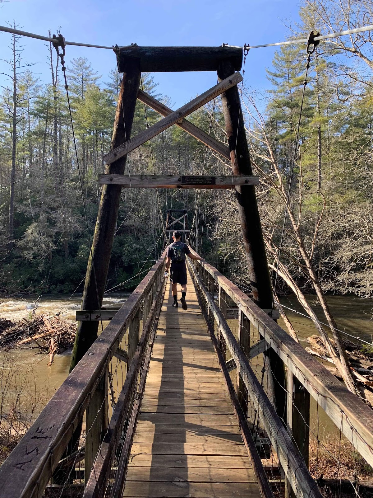
Darnell Creek before the crossing

Darnell Creek crossing

After Darnell Creek there is a gravel road descent to pavement that leads to the Rabun Gap/Dillard area where we have a mandatory stop to confirm our race trackers are working.

Rabun Gap check in

I eased on in to the checkpoint at Rabun Gap and stopped for a while to recover and eat a sandwich.

In Rabun Gap

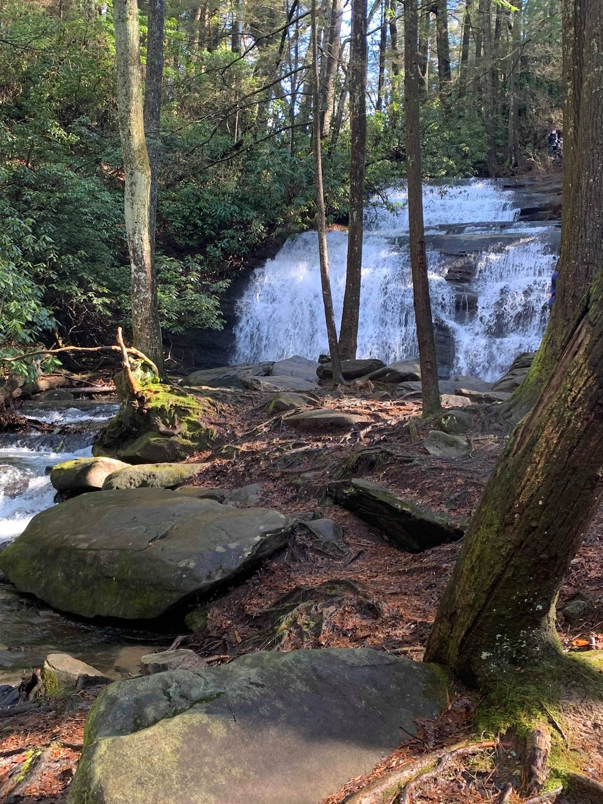
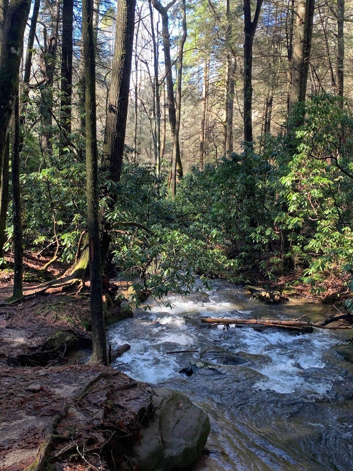
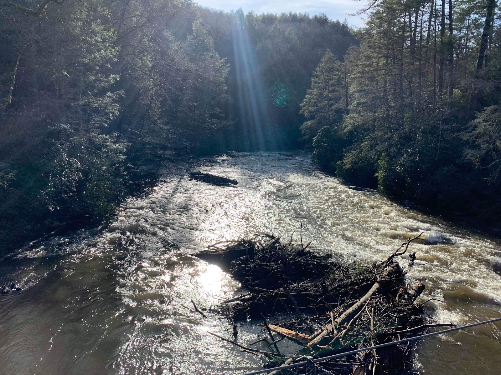
After Rabun Gap the next landmark for me was the crossing at Charlie's Creek.  There are several significant climbs to get there.  Along the way, somewhere after Patterson gap,  I met up Jamie Foster.  We rode together for a while on our way to Charlie's creek, where I had a nice bonk and needed to pause and rest.  She was feeling good and continued on ahead of me.  To get to Charlies Creek you go through the Tallulah river campground along the Tallulah river.  Its a beautiful area, the river is filled with massive boulders and tree blow downs.  The river was high and flowing strong from all the rain that hit the area the week before.

bob


Tallulah River

was here

There is a woman that comes out each year to provide "Trail Magic" at Charlie's Creek.  Bananas and nutty butters for the win!  I remember in 2019 she had a chair out in the middle of the creek.  She sat there enjoying the show as riders attempted to cross the wide creek filled with rounded baby head stones.  It's something to see.  If you pick the right line you make it.  Choose the wrong line and you may hit a rock that stops you, or you may end up in the deep end with no where to go.  It's a cool spot. 

Charlies creek crossing and status update

After recovering my next goal is to make it to marina at Lake Rabun.  There are a few restaurants there and if I could make it in time I could get a nice meal before heading into the night.  I was able to get there about 8pm, I think an hour before they closed and had a pizza and salad at Milton Park.  It was super awesome to make it in time. 


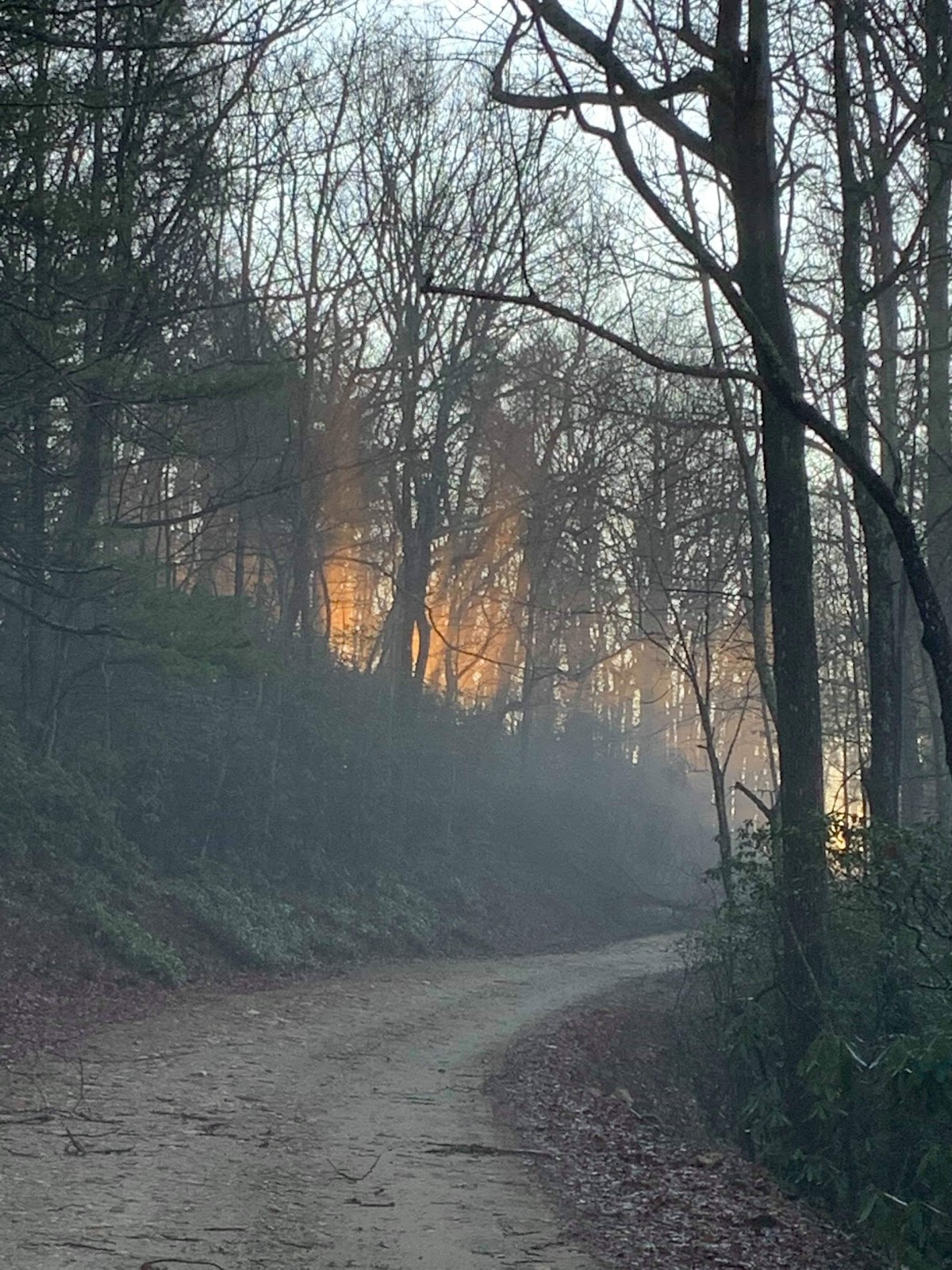
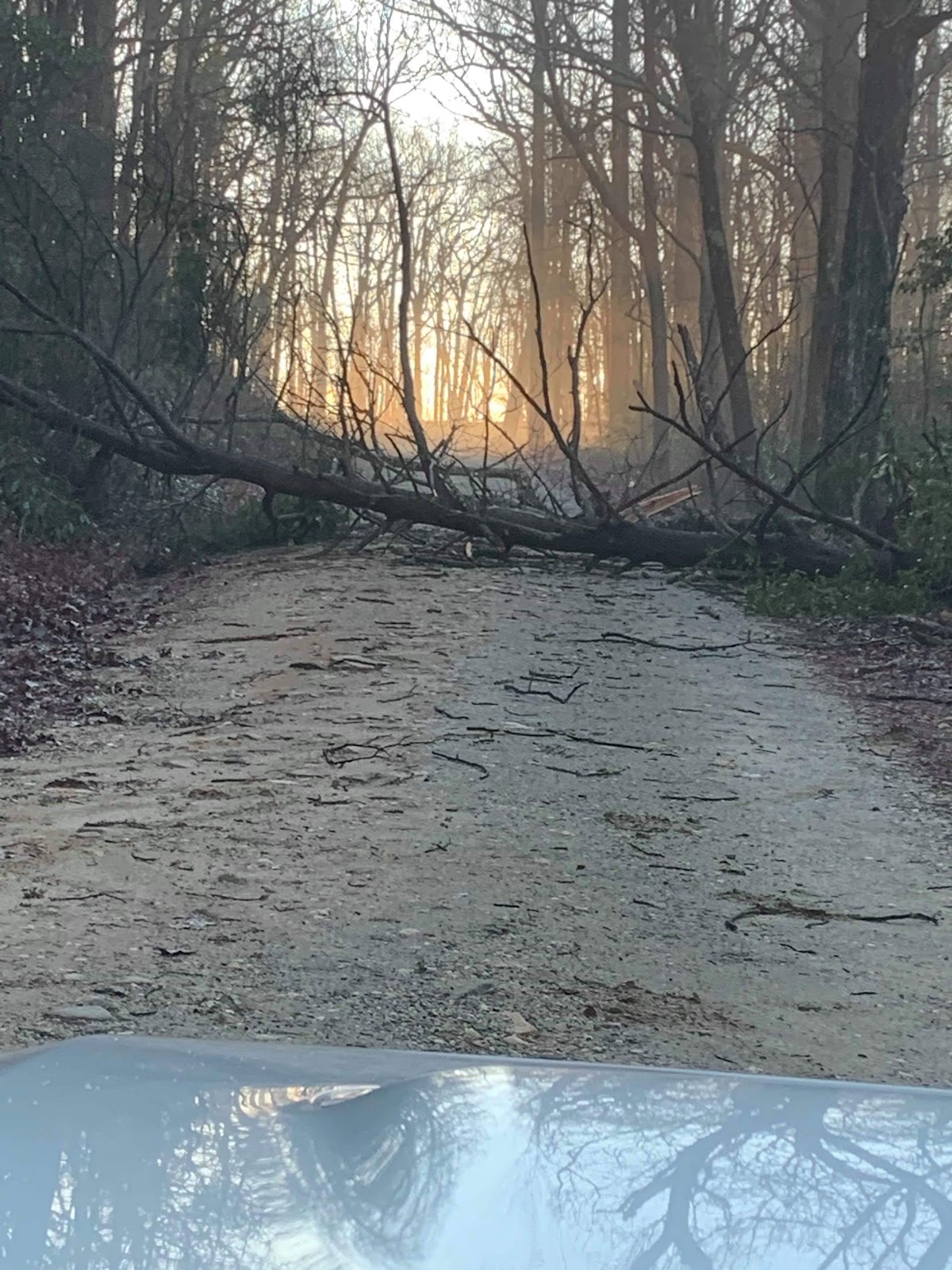
After Milton Park I headed up towards Wildcat campground in the dark.  I decided that I'd sleep at the upper campground.  I had hoped of making it to Woody's near Helen the first day but it wasn't going to happen.  I was tired and it was time to sleep.  I laid out my bivi and was fast asleep.  

9/22 Day 2: Wildcat to Aska Trails
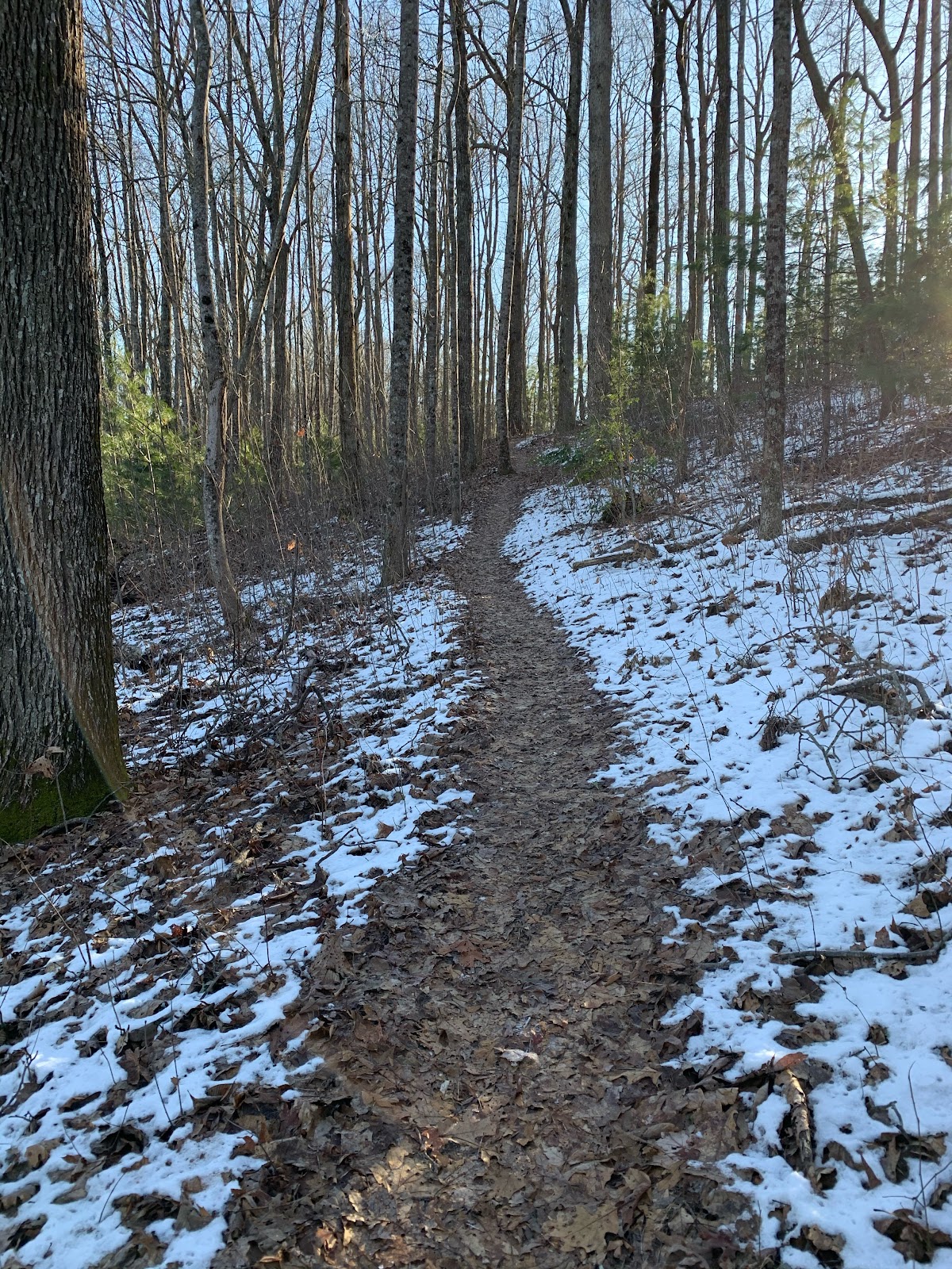
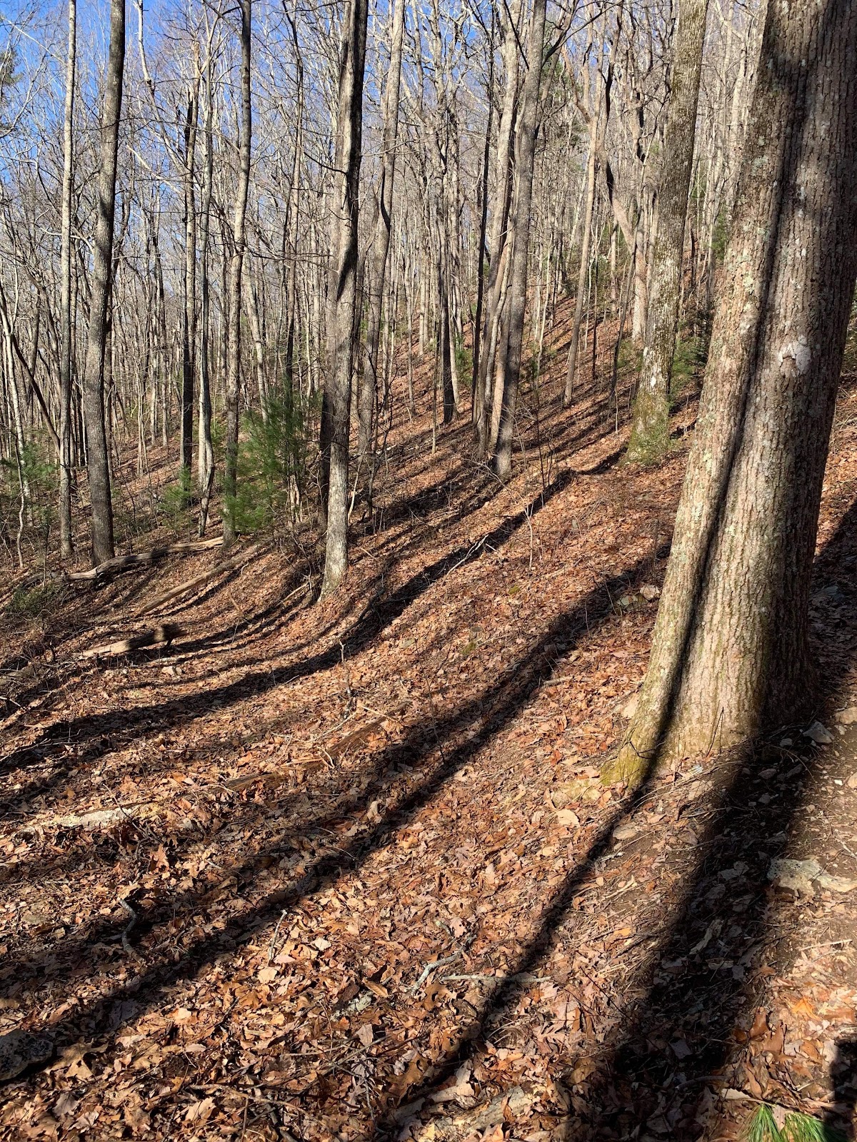
I probably got about 3 hrs of sleep before the rain started.  It was light at first but got heavier and heavier.  I came close to just curling up and trying to wait it out in the bivi but decided it was best to get up and push on.  It was about 4am.  The next landmark was Helen.  I wanted to get there and have a nice breakfast.  I would need to get over Addis and Tray Mtn before the trail would trend down into the Helen area.  Tray is a crazy long climb.  I think about 9 miles on a forest road.  The sun came up before I reached the top.  On my way I saw two bear cubs climbing down a tree as I passed.  I must have scared them up there without knowing and I never saw momma.  Those would be the only bears I'd see on the entire ride.  After getting to the top of Tray there is a rocky rutted out doubletrack trail that is super technical and challenging to get into a fluid rhythm.  If you survive that you then get to ride Hickory Nut, another challenging ride on I think a very old forest service road that is now more like a wide bench cut trail with mail box sized sharp rocks and low hanging trees.  Its down hill and you want to fly.  With all the enough hidden obstacles I try to keep under control but still come to going OTB a few times.  There are a few sections near the end that you can let it rip and it's super fun.  After that you hit the pavement and it's mostly a downhill cruise into Helen.  My stomach wasn't in great shape since the start of my ride and I reached Huddle House with a poor appetite.  I stayed there a while to try to recover and finish my meal.  I wondered if I'd get sick right at the bar while staring at my plate and how that might go over with the staff.  I probably stayed there for over an hour and left feeling better but not 100%.  As I was leaving I saw Matt and Marcus Mustin coming in.  I'd end up seeing them later that day and spending alot of time with them over the next several days.

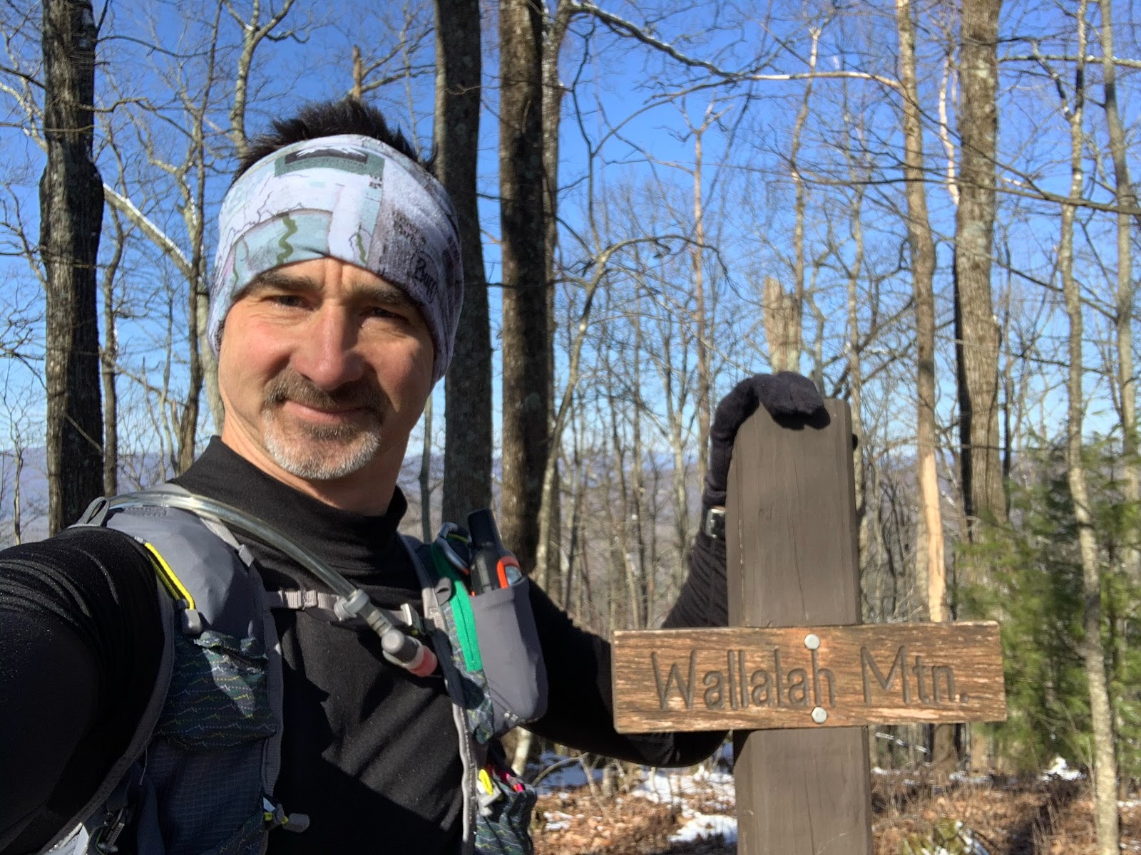
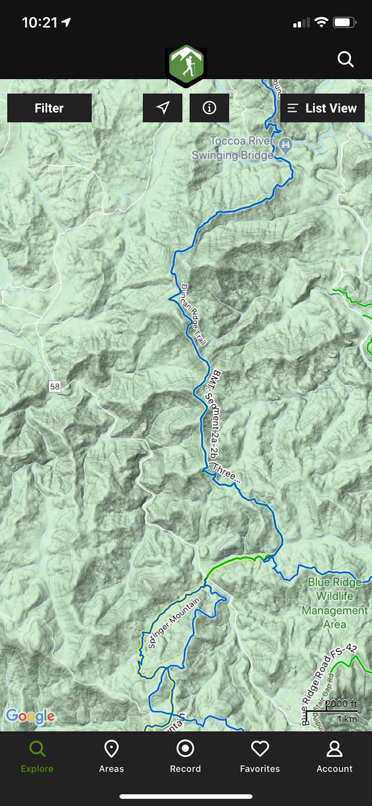
Leaving Helen I saw Lucas, with several other riders, at one of the restaurants before the turn to head out of town.  We rode some of the race together in 2019.  I had a good idea I'd see him at the next landmark if not sooner.  I kept rolling.  The next challenge is getting up to the top of the Duncan Ridge Rd.  To get there we have to go up Hogpen, WolfPen and then the Duncan Ridge Rd climb.  If you look on an elevation chart they are significant climbs that stick out like tall back to back spikes.  I think Hogpen is about 9 miles from the start to Vogel.  Wolfpen is right after Vogel, it is just as steep but not as long.  At the end of Wolfpen you just keep climbing on up to the top of Duncan Ridge Rd.  Its a ton of climbing.  I would find my climbing legs somewhere on Hogpen.  Something just clicked for me and I was able to stay in the saddle at pace just better than walking. 

At Vogel

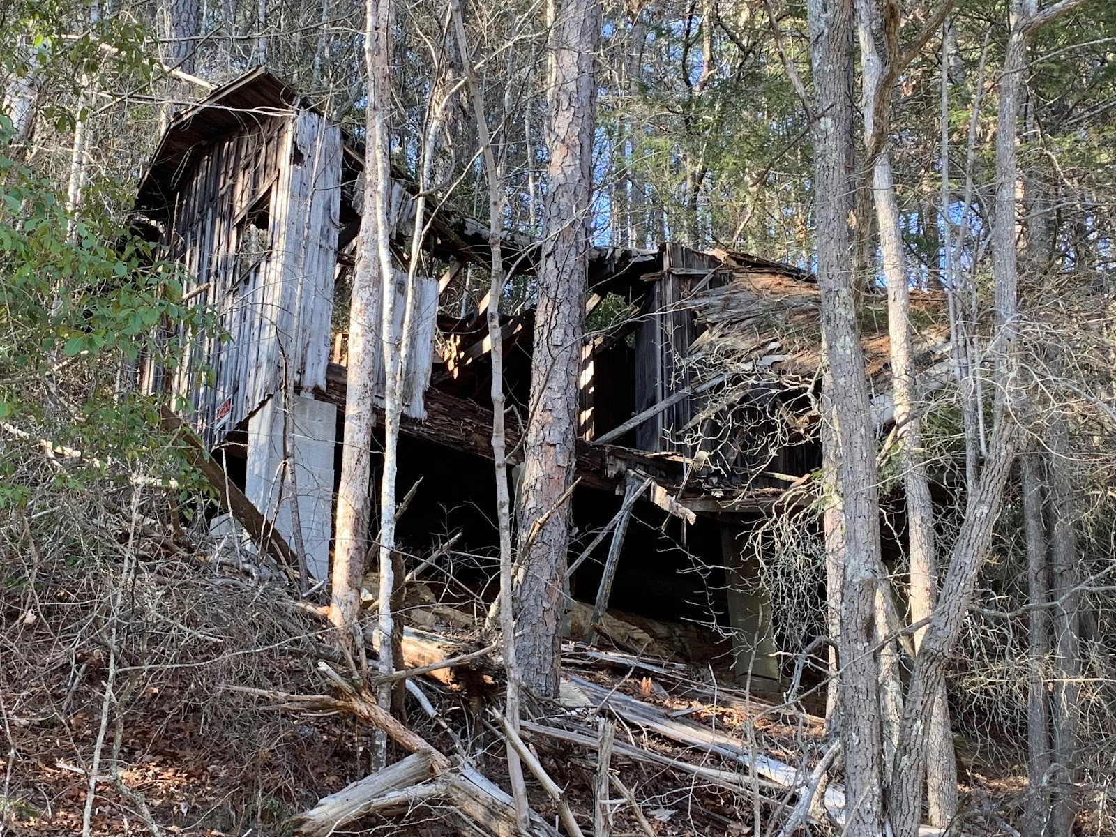
After reaching the top of the Duncan Ridge Rd it is a nice long forest road descent into the Coopers Creek Store area.  At this point I've got food on the brain. Wanting to eat is a good thing.  I enjoy the downhill and make it to the paved road to cruise on into Coopers Creek Store.  Coopers Creek Store is a complete oasis.  The owners roll out the red carpet for TNGA riders.  They track us, know our names when we come in and provide us with a place to sleep and eat.  They are truly wonderful people.   When I arrive I see Matt and Marcus placing their order.  I find a spot to put my bike and claim a spot to sit for the next hour or so.  I'm going to be here a while.  I order some food and some of the other riders start to arrive.  Lucas and a group of 4 or 6 roll in including Jamie.  I enjoy reconnecting with Lucas and find out that he is ending his ride here. We all hang out, tell stories and discuss options for the evening.  Some are going to stay and some are going to keep going.  Matt, Marcus, Jamie and I would continue on towards the Iron Bridge.  I had wanted to get over Stanley Gap but I didn't see that in the cards any more.  I figured I could get to the Aska Trails area just before Stanley and tackle it early in the morning. I would leave later than the others and ride solo to the Iron Bridge.  It was a nice evening.  The rain had stopped earlier and the sky was clear and lit up by the full moon.  I crossed the Iron Bridge and met a rider that was pulling the plug.  He let me know that the others were sleeping up at the Riverside Restaurant.  The were laid out under the entry way and I would have joined them but I didn't want to sleep on concrete without a sleeping pad.  I rolled on and made it to the Aska Trails trailhead before Green Mtn.  I found a nice soft spot, enjoyed the moonlight and quickly fell asleep.

9/23 Day 3: Aska Trails to Mulberry Gap
bob


Monday, May 17, 2021

2021 Cruel Jewel 50 Miler Race Recap


Dragon Spine on the Duncan Ridge Trail (DRT)

The TL;DR:

I was able to finish a long, tough race in the Georgia mountains with great support from friends and family. Thanks to everyone. I’ve never appreciated comfort as much as I have after being uncomfortable. Just finish. That is all that matters.

The long form:

Perfect day, perfect conditions. What a great day to spend in the woods with friends and family.

We came up to Blue Ridge the night before and we were able to spend some time with the Hopton’s. We had trained together on the course and it was nice to hang out and meet everyone's family. Truly a great time. We then made our way to Blairsville for the evening with plans to see the Hopton’s again in the morning after I picked up my packet. Well that didn’t go as planned. I forgot that I had signed up for the shuttle from Vogel and my packet wasn’t at the start when I arrived. It came over on the shuttle and was no big deal. But until I had the bib in hand, I was a bit uneasy.  After I got my packet, the start area filled up with all the racers and crews. I met up with the Hopton’s and with Robert and Darrell. The air was cool and fresh with little to no breeze. This is perfect.

The Hopton's

Darrell and Robert

Start: Mile 0.0

The race was broken up into a few waves. Mine was the second. We reached our start time and eased out walking. Some runners actually ran. I walked it out and followed a pattern of walking on the inclines and slow running on the flats and down hills. It wasn’t long before we hit the first real hill as we made our way up Aska Road. I felt great. Easy does it. This is awesome.

Darrell and Robert's start wave

Deep Gap: Mile 2.7

After a few miles, we dropped into Deep Gap and the first aid station. I picked up a lil water and passed through onto the Flat Creek Loop. Still taking it easy. Walking the ups and slow running the downs. All systems in check. We return to Flat Creek aid station where I fill up on some water and grab some tasty Fig Newtons. I remember how good they tasted. Yummy!

Deep Gap: Mile 8.5

I left the aid station with the Hopton’s and we made our way up Stanley Gap. They outpaced me and I continued up slowly. All systems in check. I passed a few 100 milers along the way. They looked rough. Glassy eyed and pale faced. Some of them I would see again the next day. Cresting out on Stanley, we take a right on the BMT down to Weaver Creek Road. This is a beautiful trail. There is a hill side that is completely covered in ferns. The bench cut trail follows the contour of the hill and there are huge lush green ferns as far as you can see in every direction. Love this spot. This trail is crazy steep and drops you down to the next aid station at Weaver Creek Road. I meet up with the Hopton’s at the aid station as they are preparing to head out. I have a grilled cheese sandwich hot off the skillet. Oh man, it tastes amazing. I also have some watermelon. Oh man, all this stuff tastes so good. This is awesome.

Weaver Creek: Mile 13.5

I turn and leave the aid station. It is straight up for a long way. I take my time and do my best to take it easy.  I ran into Darrell and Robert on the way back up the BMT.  At the top, the BMT and Stanley intersect and we go right to the high point of the trail near Rocky Mtn. After that there is a long descent into the Stanley Gap parking area and the next aid station. I meet up with the Hopton’s again as they are preparing to leave. I grab another grilled cheese, watermelon and some fig Newtons. Man this all tastes so good. All systems in check.

Darrell and Robert on BMT

Stanley: Mile 18.9

Leaving the Stanley Gap aid station, we take a gravel road, then a paved road down to the Toccoa River where we cross the old steel truss Shallowford Bridge. We make our way on the other side of the river for a short bit and then head back into the woods. We have a few miles to get to the Old Dial Road aid station where I’ll see my crew for the first time since the start. Our crews were amazing and took such good care of us. They had a chair for me and got me everything I needed when I was there. Truly an emotional boost to see them and have their support. The Hopton’s are still at the aid station when I arrive and we hang out for a few minutes before they continue on. I have some ramen with broth and some more watermelon. It tastes really good but I’m starting to get an uneasy feeling in my stomach.

Hopton's arriving at Old Dial Aid Station


Arriving at Old Dial Aid Station

Old Dial: Mile 24.8

I leave the aid station headed for Wilscot Gap in 5ish miles. I’ll see my crew again there. Some steep climbing in this section. I’m doing pretty good. I’m still drinking and eating but there is discomfort in my stomach. I pass the Brawley Mountain fire tower and then the overlook for Lake Blue Ridge and descend into Wilscot Gap. I meet up with my crew and see the Hopton’s before they head out. I have a Coke and that helps my stomach feel better. I eat a little bit but not much. Things aren’t tasting good any more.

Hopton's at Wilscot Gap Aid Station

Arriving at Wilscot Aid Station

DAS NOT GOOD!

Trouble brewing

Wilscot Gap: Mile 30.3

I leave the aid station and head out for the next 5 miles to Skeenah Gap. This section doesn’t seem to have as many steep inclines. I make my way and try not to push too hard. I’m pretty much done wanting to eat. Just isn’t good any more. I’m still keeping within my time range though. My thoughts are anything under 20min/mile is money in the bank. I’ll reach Skeenah with about 40-50 mins in the bank. My stomach has gone sideways and I’ve purged demons a few times before I descend into the aid station. I meet up with my crew and see the Hopton’s. We get dressed up for the night and take a picture of the three of us. I’m sitting in the chair and about to toss my cookies. I think right after that photo I’m giving it up as they are headed out. I drink some coke and Mountain Dew. About the only things that taste good. I remember one moment Cristy and I shared a look. She knew I wasn’t well and did what she had to do to get me going. In my head I was having a moment. Save me! Oh well nothing to do but press on.

Arriving at Skeenah Gap Aid Station

I am really not well

Skeenah Gap: Mile 35.2

I picked up some chicken broth leaving the aid station and sipped it on my way up Rhodes Mtn. One of the toughest of many tough climbs. I’d stop and drink. Hike a bit. Stop and drink. I made it about half way up before I lost it all. For the rest of the race, I’m happy to get sick because I’ll feel good for a short period of time. From this point on, I didn’t consume anything that stayed down. For the next 15 hours, I’ll be in a deficit on food and water. Oh well, nothing to do but keep moving. I make it to the top of Rhodes and I’m extremely elated. That is a tough climb with a long steep descent after it. We are now on the Duncan Ridge Trail that is referred to as the Dragon Spine. It gets this name from sticking out like vertebrae on the spine of a sleeping dragon. It’s completely dark now and I’ve got my head lamp on.  From here to Coosa Bald, you can often see the lights of Blairsville off to your left.  My pace has slowed considerably. I’m hitting 40-50 min miles on ascents and maybe in the 25s on the descents. From this point on, I listen to the owls throughout the night hooting and hollering. It’s an amazing experience. I keep moving on to the Fish Gap aid station. I meet up with the Hopton’s again (I think, not certain) as they are leaving. This will be the last time I see them (or think I see them). They will outpace me for the rest of the race and finish strong a few hours ahead of me. I have some coke at the aid station. It’s the only thing that feels good. I take 10 mins or so sitting in a chair near the fire. It feels great. I close my eyes for a bit and then it’s time to keep moving. I see several runners doing this. One lady I leap frogged a few times stayed longer than me, and I remember her flying past me near the finish. Whatever her approach was it certainly worked.

Fish Gap: Mile 40.1

I leave Fish Gap with 7ish miles to get to the next aid station named Fire Pit. This is by far the hardest section for me. There are several steep climbs and my brain isn’t working well. I’m having negative thoughts. Why am I doing this? Whose idea was this? Why am I signed up for TNGA next? I was having a pity party. It didn’t last long. I got over it and refocused myself. There is only one thing. Finish. That is all that matters. I never had another negative thought. Keep moving and finish. I’m mentally misplacing the order of landmarks now. More than once, I thought I was starting the Coosa Bald climb which was miles yet to come. I’d peak out on a hard climb and realize it wasn’t Coosa and be a bit demoralized. The Coosa Bald summit became a thing in my mind that I had to get to. It would be the turning point. If I can just reach that it will be mostly down hill and I’ll practically be done. Where the hell is it? During this section, I adopted a pattern of resting and shutting my eyes for 2-5 mins. I’d hit a climb, get exhausted and then sit or lay down. I’d look at my watch and after some preset time in my head, I’d get up to resume the climb. I’d often get sick, but whatever feels good can’t be bad. I’d lay on the ground in the darkness and every now and then I’d see headlamps approaching. This helped get me back up on my feet. Before reaching the Fire Pit aid station I was absolutely convinced I had missed it. By my math, I was sure that I must have passed it miles ago. I laid down on the side of the trail and was wondering if I’d be disqualified. How did I miss it? Did I just zone out and walk right past it? I mentioned this to a runner as he was passing me. He told me that I hadn’t missed it and in fact, it was just about 100 feet further up the climb. Oh man, that really boosted my spirits. I was really wanting some coke with ice. That was so strong in my head. Coke with ice would save me. I got up and made my way to the aid station. I got some coke with ice and it was everything I needed. More please. I probably had 3 cups of it. Just made me feel better. I sat down near the fire and then noticed all the bodies laying on the ground around me. Some covered, some not. Just laying there. It looked like a great idea so I tried it for a little bit but it was too cold. I sat down again and closed my eyes for 10 minutes. Then it was time to go. Just finish!

Fire Pit: Mile 47.4

I left the aid station with one thing on my mind, Coosa Bald. As I approached the climb, I tried to take it slow enough that I could just keep moving. Before I knew it, I was on the summit. Whoot!! Getting over that was a huge boost. There is a long steep descent after this headed to the last aid station at Wolf Creek. It would be during this section that I would see the sun come up and feel the morning arrive. The birds were singing and the forest came alive. It was magical. The temperature was perfect. I was back in just a tee shirt and happy to be in the woods. I’m going to finish.

Wolf Creek: Mile 52.1

I never doubted finishing and my mind was now fixated on it. Get to the finish. After the last aid station, there is a tough climb for about 3 miles that never seems to end. It’s the last kick in the butt before you have a mile or so down hill to the finish. It follows the side of the mountain on an incline back and forth. It keeps you wondering if it will ever end. It does. I finally finish the climb and cross the road into Vogel. Now I had just a bit further to go - all down hill. It was in the bag. I got emotional often as I made my way through the park onto the last stretch. I always do. All I have to do is think of Cristy and Spencer being there at the finish and I tear up. I send them a message that I’m close and that I’d love a Coke with ice!! Yeah I’m thinking about that also. Man wouldn’t that be awesome. I hit a spot where I can see Spencer and I tear up a bit. I meet up with him and we finish together. I tell him how important it is to finish what you start and to never give up. I can see the finish and Cristy and get emotional. There are several people there and I focus on just getting to the line and it is over. I thank the organizers at the finish. I pick up my fancy belt and grab a coke with my awesome crew.

Be the ball Danny


Chair please


Oh DAS GOOD!

Vogel: Mile 55.8

It’s so nice to have family and friends to do this stuff with. Thank you Cristy and Spencer for being there and supporting me. Could not have done this without you. I appreciate all of your efforts over the past two days. Thank you!

Thanks to the Hopton’s for their friendship and hospitality. It was heart warming to know Cristy and Spencer would not be alone. Thank you!

I think being uncomfortable makes you appreciate comfort. Sleeping in a bed is amazing.  Pillows are amazing.

I drank coke and ice for the rest of the day till we got home and I passed out. I got up about 9 pm to eat and had another coke and ice. Then went back to bed. Coke and ice for the win!

Thanks Babe!


Sunday, February 23, 2020

BMT Swinging Bridge to Shallowford Bridge


Feb 22 2020

Epic day for 24ish miles on the BMT from Swinging Bridge to Shallowford Bridge.  


I think this is Tipton mountain, or the bump just before it, as you travel from Morganton to Wilscot Gap on hwy 60.  I wasn’t expecting there to be any snow and wondered what the starting temp was going to be.


The answer is 20.  20 degrees with zero wind and a clear sky isn’t that bad.  I had prepared for frigid temps with two layers on top, running pants, warm gloves, a balaclava, and a beanie.  A puffy was a game time decision and I’m glad I left it in the truck. In less than a mile on trail it felt like a day at the beach (a cold day).  I dropped the top layer, gloves, balaclava, beanie and was still breaking a sweat. The pants came off soon after that.  For the rest of the day I had a single layer, buff and light gloves and a backpack full of clothes I didn’t need.  That combination worked perfectly.


The first climb of the route on Toonowee Mtn had a light dusting of snow on the shaded side of the ridge.


I crossed hwy 60 at mile 4 and refilled my water from the small cache I placed earlier.  I made my way towards Wallalah Mtn passing several runners that were out training for the Georgia Death Race (GDR).  The trail switched back and forth gaining ground on the summit and allowing a nice look back at Toonowee Mtn.


The BMT is all about ridge lines and summits. If you are wondering where the trail is headed just look for the nearest high spot, that’s it. I continued on the switchbacks and hit the top of Wallalah at mile 6 enjoying the views.  Off the back of Wallalah there was a bunch of snow and I took the video below.  

If you click the link you can control the playback resolution.


It’s interesting how some areas hold cold air even though they get full sun.  The back side had about two inches of snow and was significantly colder.  It felt like a winter playground.  


Continuing on I passed Licklog Mtn and got to the junction with the Daniel Ridge Trail.  I knew from the BMT guide that there was a nice overlook just up the DRT a short distance near the summit of Rhodes Mtn.


The overlook was off trail about 50’ or so with a rock base covered in green flaky Lichen.  


Views of Licklog and Wallalah Mtn (I think).


I dig these gnarled up trees.  It seems like they grow this way on mountain tops or areas with exposure.  I recall similar trees at the summit of Springer Mtn.

Leaving the overlook, I descended back to the BMT drinking the last of my water with about a mile or so to reach my resupply at Skeenah Gap.  I met up with a few GDR runners headed the same way.  I spooked one leaving the overlook and then got passed by another one on the way down.  They were impressively quick on their feet and out of sight in an instant.  Hi and goodbye.

Skeenah Gap is mile 10 and where my friends Les, Brenda, Dan and their dog Bandit had parked.  They were doing the second half of the route and had left water for me.  I took a short break feeling a bit tired and hungry.  I was consuming about 200cals/hr and felt hungry all morning.  I started eating the jerky and had a big gel with caffeine.  My friends were hiking and had about a 4 mile lead.  I wanted to catch up to them before the Brawley Mtn Fire Tower and decided to pick up the pace.

My next resupply was at Wilscot Gap at mile 15.  I put my camera down and worked to make time.  I passed through Payne Gap, crossed over Wilscot Mtn and descended into Wilscot Gap to refill my water.  Crossing Hwy 60 I ascended an old roadbed towards Tipton Mtn.  This section was steep, long and shaded from the sun.  The temps dropped and the work was hard.  I was thankful when the road turned into switchbacks and the grade diminished.  

The route summits Tifton Mtn and the follows a descending path curving around the north west side giving views of lake Blue Ridge.


Views of lake Blue Ridge from Tifton Mtn.


Lake Blue Ridge is larger than I expected.  At about this point I had exchanged a few messages with my friends and I knew they were close to the tower or already there about a mile or so ahead of me.  As I made my way around the south side of Tifton Mtn I could see the tower.


Brawley Mtn Fire Tower.  The group was waiting for me here.  I was hoping the tower would be a cool place to hang out.  I envisioned an open air deck with spectacular 360 views.  I’ve been to other towers that are destinations in themselves.  For example the tower at the top of Rabun Mtn.  That is a outstanding spot to hang out.  This tower wasn't that kind of tower or experience.  It was dilapidated and off limits (to most of us ;).


We hung out for a little bit, snapped a few pics and took off.  I was disappointed it wasn’t the cool experience I had hoped for.

The trail off the back of Brawley Mtn goes through a section of forest with huge high canopy trees widely spaced on a bare floor. It’s a wide open area bordered on the north side by a tall rock face along the base of Brawley Mtn.  It’s spectacular.  I’d like to see this area in the spring.

The route trends down towards the Toccoa River with a few steep grunts, because it’s the BMT!  I’m pretty much toast by the time I reach the intersection with Shallowford road and don’t see the trail on the other side.  I’m a bit ahead of the group and continue on down the road until I get that uneasy feeling.  A quick map check confirms it and I turn around getting an extra bonus mile or so.  I meet up with the group and we all finish the trail together.


A good spot on the Toccoa River for a cabin fixer upper.


At the finish with the Brenda, Les, Dan and Bandit.


We enjoyed a few beers sitting in the sun by the river before calling it a day and heading home. It was an epic day with perfect conditions.  The BMT rocks. I look forward to the next sections.

My mileage ended being about 24 miles with 7k of gain in 8hrs.  Here is Strava info:

.

Monday, January 13, 2020

BMT Start to Swinging Bridge (ish)


Spent the day with my buddy Michael Hopton hiking from the start of the BMT to the Swinging Bridge spanning the Toccoa River.  Well, almost from the start...  

The Plan

The plan was pretty simple.  Two guys, two vehicles, a dog and a 16-17 mile point to point route from the start of the BMT to the Swinging Bridge.  Michael would leave his vehicle at the Bridge and I’d leave my truck at Springer.  

It was a nice plan that didn’t go as expected.  

Shocking as always 🤔.  

A storm had come through the area the night before that downed trees, power lines and seemingly cutting off all access to our destinations.  Just getting close was a challenge due to dense fog and debris scattered on the roads.  Our main route and second alternate ended up being completely blocked by large downed trees. 


The tree above was blocking our alternate route attempt to access the bridge via forest roads.  This was up FS 58 about 100 yards from the top near winding stair.  We backtracked and found another access via the roads.

We then ended up getting blocked from accessing Springer.  


The tree above was about a mile or so up the forest road to the Springer parking lot.  So we changed our plans and decided to start from Three forks.  

Next trip I’m gonna bring the chain saw.

The Route


We ended up parking my truck on FS 58 at three forks where the AT and the BMT (green trail near bottom) cross.  We did the loop below 58 clockwise, starting on the BMT and returning on the AT, just to get some additional miles in for our shortened adventure.  It was a good choice.  We got to see that part of the BMT and enjoy the steep up hill climb!

Although it rarely felt like it: “The route trends mostly down hill” 😆 

Once back to 58 we dropped some unneeded gear at the truck.  It was very warm and I unloaded all of my cold weather gear.  I wished I had brought an even lighter shirt.  I was already sweating pretty good.  70 degrees in January.  Who knew 🤷🏻‍♂️.

Leaving the truck we headed up the trail to Long Creek Falls.


I watered up at the falls and then we continued on a steep uphill section to an unnamed bald.  Ruby got to play and we enjoyed the impressive scenery. 


Leaving the bald we descended (because it trends down 😉) to No Name Gap.


From No Name Gap we climbed up steeply towards Wildcat ridge and onto the shoulder of Big John Dick Mountain.  The shoulder is an awesome tight bench cut trail.  This is one of the most runnable sections and an absolute blast. It switchbacks down into Bryson Gap where I planned to get more water.


Water at Bryson Gap can be found on either side of the Gap.  I chose poorly and headed down the side with an itty bitty trickling spring.  It was tough getting water and I clogged my filter.  The funny part is that we (me) took a wrong turn after this and ended up heading down the other side of the gap where our feet had to get wet crossing a significant stream.  I’ll know better next time.


The pic above shows the way down to the good water access.  I thought it was our route and we descended down about a half mile before figuring it out.  Oh well bonus miles it is.

I remember reading about this turn in the trail guide: the trail heads a short distance down the NW side of the gap on an old lumber road, then shortly bears away from the road up the right bank. Be careful not to miss this turn or you may hike a long distance in the wrong direction until you discover the folly of your ways.

The “Folly” is certainly in my ways.  😆 

Leaving Bryson Gap, on the correct trail, we followed a runnable ridge with views of the surrounding valley and bordering ridges.  You could tell we were approaching the Toccoa River.


The drop down into the Toccoa was steep and we took our time to enjoy the crossing.  The river was high and raging through its banks.  Trees and debris gathered in random areas staged for the next storm to wash them further down the river.


Crossing the bridge I was thankful for the day, the company, the warm sunshine and the cold beer just a short hike away.


Thanks to Michael and his dog Ruby for joining me on this little adventure.  It is always more meaningful to have company to share experiences with.  And thanks to Michael for all the photos!

Good times.