|
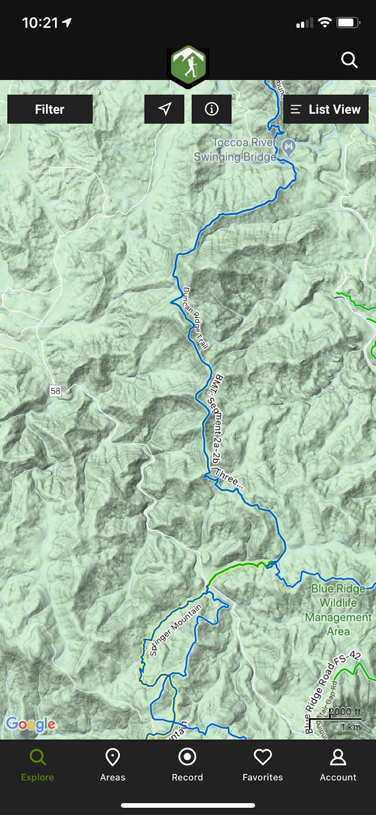
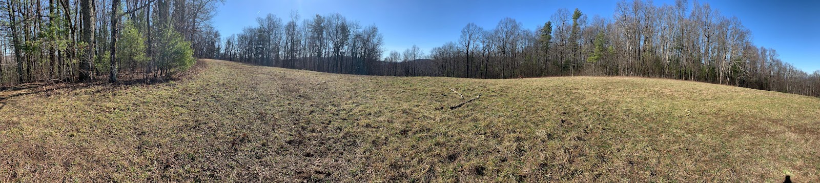
| Dragon Spine on the Duncan Ridge Trail (DRT) |
The TL;DR:
I was able to finish a long, tough race in the Georgia mountains with great support from friends and family. Thanks to everyone. I’ve never appreciated comfort as much as I have after being uncomfortable. Just finish. That is all that matters.
The long form:
Perfect day, perfect conditions. What a great day to spend in the woods with friends and family.
We came up to Blue Ridge the night before and we were able to spend some time with the Hopton’s. We had trained together on the course and it was nice to hang out and meet everyone's family. Truly a great time. We then made our way to Blairsville for the evening with plans to see the Hopton’s again in the morning after I picked up my packet. Well that didn’t go as planned. I forgot that I had signed up for the shuttle from Vogel and my packet wasn’t at the start when I arrived. It came over on the shuttle and was no big deal. But until I had the bib in hand, I was a bit uneasy. After I got my packet, the start area filled up with all the racers and crews. I met up with the Hopton’s and with Robert and Darrell. The air was cool and fresh with little to no breeze. This is perfect.
 |
| The Hopton's |
 |
| Darrell and Robert |
Start: Mile 0.0
The race was broken up into a few waves. Mine was the second. We reached our start time and eased out walking. Some runners actually ran. I walked it out and followed a pattern of walking on the inclines and slow running on the flats and down hills. It wasn’t long before we hit the first real hill as we made our way up Aska Road. I felt great. Easy does it. This is awesome.
 |
| Darrell and Robert's start wave |
Deep Gap: Mile 2.7
After a few miles, we dropped into Deep Gap and the first aid station. I picked up a lil water and passed through onto the Flat Creek Loop. Still taking it easy. Walking the ups and slow running the downs. All systems in check. We return to Flat Creek aid station where I fill up on some water and grab some tasty Fig Newtons. I remember how good they tasted. Yummy!
Deep Gap: Mile 8.5
I left the aid station with the Hopton’s and we made our way up Stanley Gap. They outpaced me and I continued up slowly. All systems in check. I passed a few 100 milers along the way. They looked rough. Glassy eyed and pale faced. Some of them I would see again the next day. Cresting out on Stanley, we take a right on the BMT down to Weaver Creek Road. This is a beautiful trail. There is a hill side that is completely covered in ferns. The bench cut trail follows the contour of the hill and there are huge lush green ferns as far as you can see in every direction. Love this spot. This trail is crazy steep and drops you down to the next aid station at Weaver Creek Road. I meet up with the Hopton’s at the aid station as they are preparing to head out. I have a grilled cheese sandwich hot off the skillet. Oh man, it tastes amazing. I also have some watermelon. Oh man, all this stuff tastes so good. This is awesome.
Weaver Creek: Mile 13.5
I turn and leave the aid station. It is straight up for a long way. I take my time and do my best to take it easy. I ran into Darrell and Robert on the way back up the BMT. At the top, the BMT and Stanley intersect and we go right to the high point of the trail near Rocky Mtn. After that there is a long descent into the Stanley Gap parking area and the next aid station. I meet up with the Hopton’s again as they are preparing to leave. I grab another grilled cheese, watermelon and some fig Newtons. Man this all tastes so good. All systems in check.
 |
| Darrell and Robert on BMT |
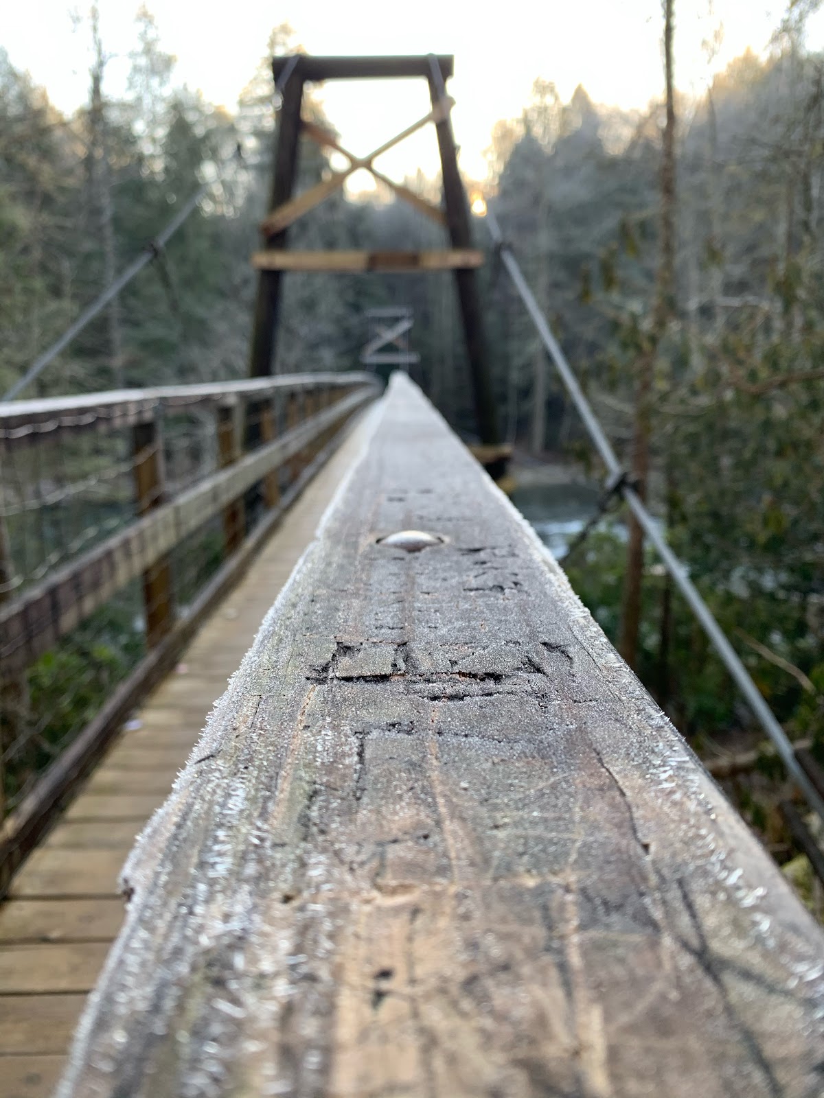
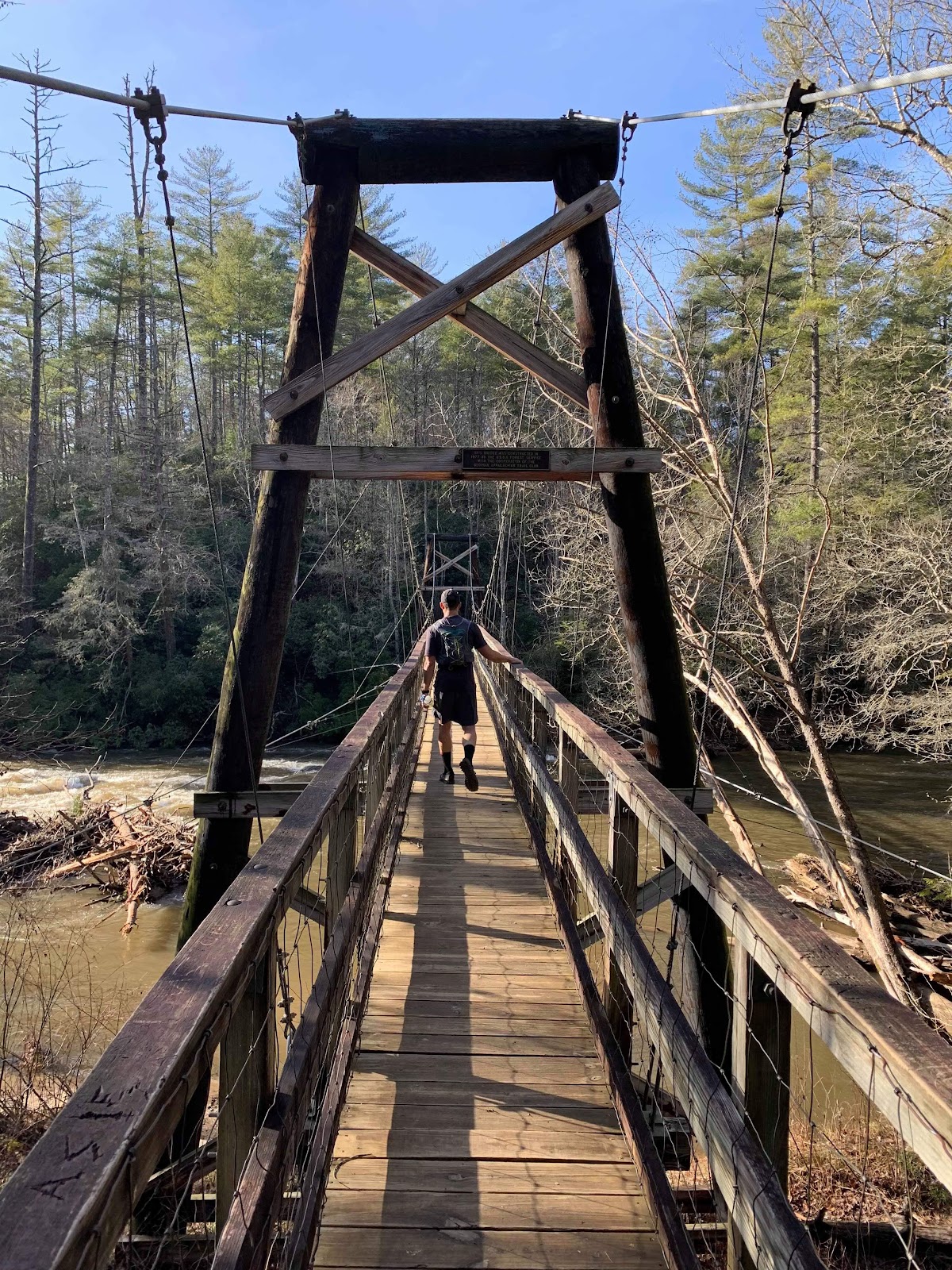
Stanley: Mile 18.9
Leaving the Stanley Gap aid station, we take a gravel road, then a paved road down to the Toccoa River where we cross the old steel truss Shallowford Bridge. We make our way on the other side of the river for a short bit and then head back into the woods. We have a few miles to get to the Old Dial Road aid station where I’ll see my crew for the first time since the start. Our crews were amazing and took such good care of us. They had a chair for me and got me everything I needed when I was there. Truly an emotional boost to see them and have their support. The Hopton’s are still at the aid station when I arrive and we hang out for a few minutes before they continue on. I have some ramen with broth and some more watermelon. It tastes really good but I’m starting to get an uneasy feeling in my stomach.
 |
| Hopton's arriving at Old Dial Aid Station |
 |
| Arriving at Old Dial Aid Station |
Old Dial: Mile 24.8
I leave the aid station headed for Wilscot Gap in 5ish miles. I’ll see my crew again there. Some steep climbing in this section. I’m doing pretty good. I’m still drinking and eating but there is discomfort in my stomach. I pass the Brawley Mountain fire tower and then the overlook for Lake Blue Ridge and descend into Wilscot Gap. I meet up with my crew and see the Hopton’s before they head out. I have a Coke and that helps my stomach feel better. I eat a little bit but not much. Things aren’t tasting good any more.
 |
| Hopton's at Wilscot Gap Aid Station |
 |
| Arriving at Wilscot Aid Station |
 |
| DAS NOT GOOD! |
 |
| Trouble brewing |
Wilscot Gap: Mile 30.3
I leave the aid station and head out for the next 5 miles to Skeenah Gap. This section doesn’t seem to have as many steep inclines. I make my way and try not to push too hard. I’m pretty much done wanting to eat. Just isn’t good any more. I’m still keeping within my time range though. My thoughts are anything under 20min/mile is money in the bank. I’ll reach Skeenah with about 40-50 mins in the bank. My stomach has gone sideways and I’ve purged demons a few times before I descend into the aid station. I meet up with my crew and see the Hopton’s. We get dressed up for the night and take a picture of the three of us. I’m sitting in the chair and about to toss my cookies. I think right after that photo I’m giving it up as they are headed out. I drink some coke and Mountain Dew. About the only things that taste good. I remember one moment Cristy and I shared a look. She knew I wasn’t well and did what she had to do to get me going. In my head I was having a moment. Save me! Oh well nothing to do but press on.
 |
| Arriving at Skeenah Gap Aid Station |
 |
| I am really not well |
Skeenah Gap: Mile 35.2
I picked up some chicken broth leaving the aid station and sipped it on my way up Rhodes Mtn. One of the toughest of many tough climbs. I’d stop and drink. Hike a bit. Stop and drink. I made it about half way up before I lost it all. For the rest of the race, I’m happy to get sick because I’ll feel good for a short period of time. From this point on, I didn’t consume anything that stayed down. For the next 15 hours, I’ll be in a deficit on food and water. Oh well, nothing to do but keep moving. I make it to the top of Rhodes and I’m extremely elated. That is a tough climb with a long steep descent after it. We are now on the Duncan Ridge Trail that is referred to as the Dragon Spine. It gets this name from sticking out like vertebrae on the spine of a sleeping dragon. It’s completely dark now and I’ve got my head lamp on. From here to Coosa Bald, you can often see the lights of Blairsville off to your left. My pace has slowed considerably. I’m hitting 40-50 min miles on ascents and maybe in the 25s on the descents. From this point on, I listen to the owls throughout the night hooting and hollering. It’s an amazing experience. I keep moving on to the Fish Gap aid station. I meet up with the Hopton’s again (I think, not certain) as they are leaving. This will be the last time I see them (or think I see them). They will outpace me for the rest of the race and finish strong a few hours ahead of me. I have some coke at the aid station. It’s the only thing that feels good. I take 10 mins or so sitting in a chair near the fire. It feels great. I close my eyes for a bit and then it’s time to keep moving. I see several runners doing this. One lady I leap frogged a few times stayed longer than me, and I remember her flying past me near the finish. Whatever her approach was it certainly worked.
Fish Gap: Mile 40.1
I leave Fish Gap with 7ish miles to get to the next aid station named Fire Pit. This is by far the hardest section for me. There are several steep climbs and my brain isn’t working well. I’m having negative thoughts. Why am I doing this? Whose idea was this? Why am I signed up for TNGA next? I was having a pity party. It didn’t last long. I got over it and refocused myself. There is only one thing. Finish. That is all that matters. I never had another negative thought. Keep moving and finish. I’m mentally misplacing the order of landmarks now. More than once, I thought I was starting the Coosa Bald climb which was miles yet to come. I’d peak out on a hard climb and realize it wasn’t Coosa and be a bit demoralized. The Coosa Bald summit became a thing in my mind that I had to get to. It would be the turning point. If I can just reach that it will be mostly down hill and I’ll practically be done. Where the hell is it? During this section, I adopted a pattern of resting and shutting my eyes for 2-5 mins. I’d hit a climb, get exhausted and then sit or lay down. I’d look at my watch and after some preset time in my head, I’d get up to resume the climb. I’d often get sick, but whatever feels good can’t be bad. I’d lay on the ground in the darkness and every now and then I’d see headlamps approaching. This helped get me back up on my feet. Before reaching the Fire Pit aid station I was absolutely convinced I had missed it. By my math, I was sure that I must have passed it miles ago. I laid down on the side of the trail and was wondering if I’d be disqualified. How did I miss it? Did I just zone out and walk right past it? I mentioned this to a runner as he was passing me. He told me that I hadn’t missed it and in fact, it was just about 100 feet further up the climb. Oh man, that really boosted my spirits. I was really wanting some coke with ice. That was so strong in my head. Coke with ice would save me. I got up and made my way to the aid station. I got some coke with ice and it was everything I needed. More please. I probably had 3 cups of it. Just made me feel better. I sat down near the fire and then noticed all the bodies laying on the ground around me. Some covered, some not. Just laying there. It looked like a great idea so I tried it for a little bit but it was too cold. I sat down again and closed my eyes for 10 minutes. Then it was time to go. Just finish!
Fire Pit: Mile 47.4
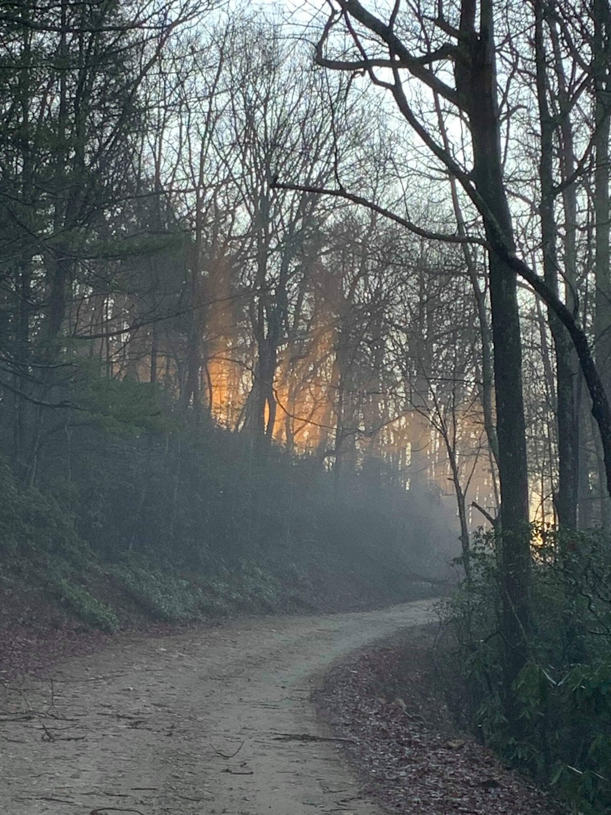
I left the aid station with one thing on my mind, Coosa Bald. As I approached the climb, I tried to take it slow enough that I could just keep moving. Before I knew it, I was on the summit. Whoot!! Getting over that was a huge boost. There is a long steep descent after this headed to the last aid station at Wolf Creek. It would be during this section that I would see the sun come up and feel the morning arrive. The birds were singing and the forest came alive. It was magical. The temperature was perfect. I was back in just a tee shirt and happy to be in the woods. I’m going to finish.
Wolf Creek: Mile 52.1
I never doubted finishing and my mind was now fixated on it. Get to the finish. After the last aid station, there is a tough climb for about 3 miles that never seems to end. It’s the last kick in the butt before you have a mile or so down hill to the finish. It follows the side of the mountain on an incline back and forth. It keeps you wondering if it will ever end. It does. I finally finish the climb and cross the road into Vogel. Now I had just a bit further to go - all down hill. It was in the bag. I got emotional often as I made my way through the park onto the last stretch. I always do. All I have to do is think of Cristy and Spencer being there at the finish and I tear up. I send them a message that I’m close and that I’d love a Coke with ice!! Yeah I’m thinking about that also. Man wouldn’t that be awesome. I hit a spot where I can see Spencer and I tear up a bit. I meet up with him and we finish together. I tell him how important it is to finish what you start and to never give up. I can see the finish and Cristy and get emotional. There are several people there and I focus on just getting to the line and it is over. I thank the organizers at the finish. I pick up my fancy belt and grab a coke with my awesome crew.
 |
| Be the ball Danny |
 |
| Chair please |
 |
| Oh DAS GOOD! |
Vogel: Mile 55.8
It’s so nice to have family and friends to do this stuff with. Thank you Cristy and Spencer for being there and supporting me. Could not have done this without you. I appreciate all of your efforts over the past two days. Thank you!
Thanks to the Hopton’s for their friendship and hospitality. It was heart warming to know Cristy and Spencer would not be alone. Thank you!
I think being uncomfortable makes you appreciate comfort. Sleeping in a bed is amazing. Pillows are amazing.
I drank coke and ice for the rest of the day till we got home and I passed out. I got up about 9 pm to eat and had another coke and ice. Then went back to bed. Coke and ice for the win!
 |
| Thanks Babe! |